The 1st/2nd Flatiron hike is one of my top three favorite hikes in Boulder, Colorado – there are so many reasons to do this hike again and again! I have done this hike about 20-30 times over the last decade.
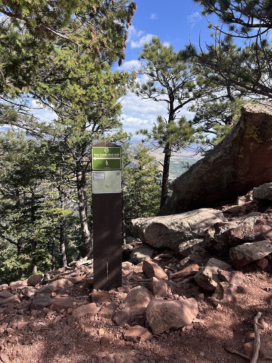
Not too long ago, this hike was an out and back (though more up and down) and ended near the back of the First Flatiron. A few years ago, a new trail the Saddle Rock Connector was built. It connects the First/Second Flatiron hike to all the trails on the West side of Green Mountain. I love this addition because I can do fun Green Mountain Summit loops or do medium sized loops via Saddle Rock trail or Gregory Canyon trail. The connector opens up so many options for hiking and running.
Why do the 1st/2nd Flatiron hike?
These are the top reasons to do the First/Second Flatiron hike in Boulder, Colorado.
- Up close views of the First and Second Flatiron as you ascend and switchback between them
- Interesting steep rocky terrain and rocks for parts of the trail
- Quickest way to views of the Continental Divide including Indian Peaks Wilderness Area and Rocky Mountain National Park
- An abundance of great spots to chill and take in the scenery
- Good starting point for a variety of loops back to Chautauqua or Gregory Canyon trailhead – more below on that below
- Perfect warm-up or training hike for harder hikes
- Can be a shorter hike or a longer hike depending on route and trail choices
Of all the hikes near Boulder, I do 1st/2nd Flatiron hike the most after Bear Peak hikes and Green Mountain hikes! Next on the list of most hiked or ran would be South Boulder Peak or the Royal Arch hike.
Where to start – the best 1st/2nd Flatiron hike trailheads
The best trailheads to start 1st/2nd Flatiron hike are near Chautauqua Park. Either is good, or in between depending on where you find a parking spot. Here are the Google Maps locations.
When to do the 1st/2nd Flatiron hike
I do this hike most months of the year. April, May, and June are my favorite months to hike in Boulder. I also like to do the 1st/2nd Flatiron hike during the Fall months. The weather can be really pleasant in September and October. Hike early in Summer months to stay cool.
When not to do the 1st/2nd Flatiron hike
This hike is somewhat exposed at the top so avoid being up high during any storms.
Check the weather forecast before you go!
Difficulty rating
This hike is hard for most hikers. The trail is steep and rises up 1500 vertical feet of elevation gain quickly over a short distance of approximately 1.5 miles
Total distance and elevation
Here are the approximate distances and elevation gain from my GPS recording.
- From Chautauqua 1st/2nd Flatiron loop trailhead – 3.43 miles, 148l feet of elevation gain
- From Gregory Canyon trailhead – 3-5 miles, 1400+ feet of elevation gain
Hiking time
How long does it take to do the 1st/2nd Flatiron hike? Depending on your pace, fitness level, and route chosen, the hike will take most hikers 1.5 hours or more to complete. I would recommend aiming for more than that because the scenery and rock is so awesome.
Terrain
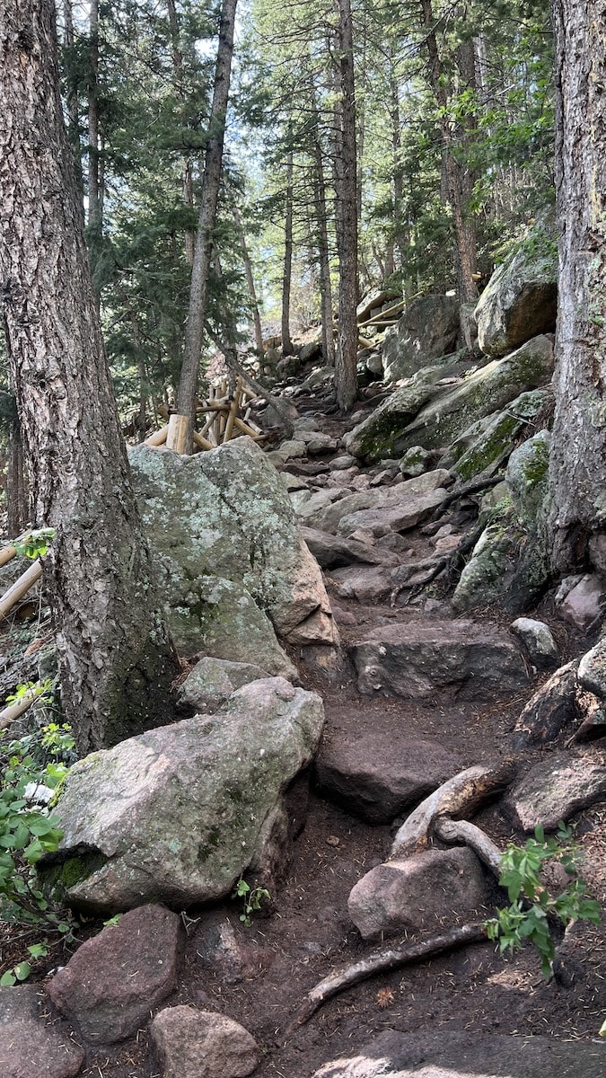
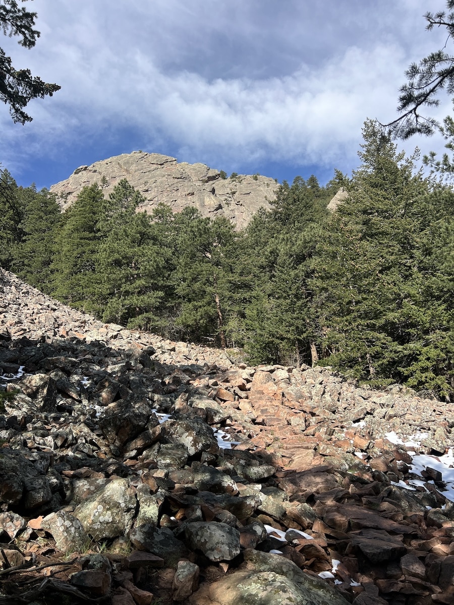
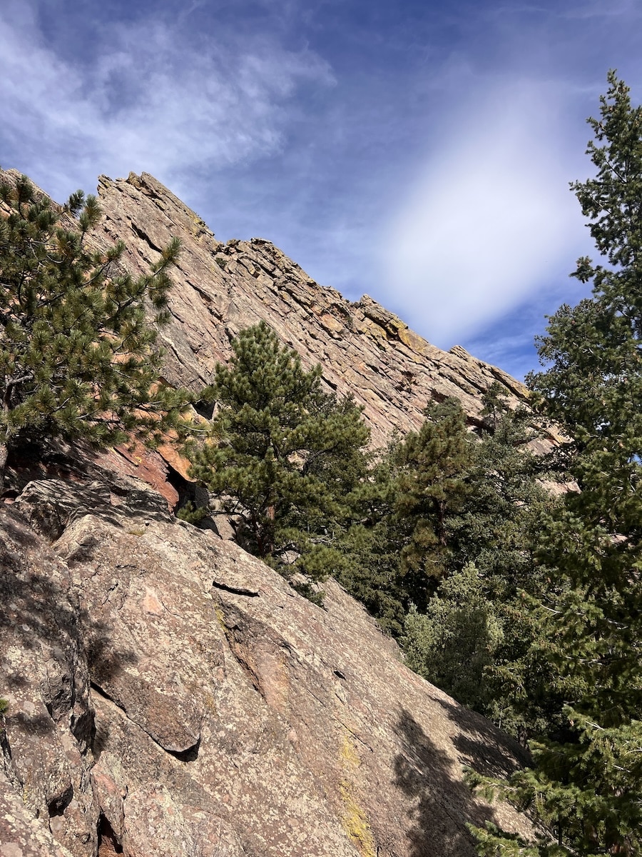
The lower part of this hike is dirt trails but eventually becomes very rocky rocky, technical, and challenging in the upper half. There is some tricky scrambling and climbing. And other parts are straight-forward switchbacks.
Gear Advisor
Most of the trails are rocky so you will want to wear footwear that protects your feet and has good traction.
Lightweight hiking shoes or trail running shoes that are breathable and designed for rugged terrain are best for this hike and most hikes around Boulder. Mid to heavier weight, less breathable, hiking shoes or hiking boots can feel too hot for hiking in Boulder many months of the year.
Some hikers might benefit from trekking poles for increased balance and stability. Or, to conserve energy and reduce stress on joints for a longer day on the trails in Boulder.
If you plan to go beyond the 1st/2nd Flatiron trail to Green Mountain Summit or beyond to Bear Peak or South Boulder Peak – make sure you have sun protection and a good hiking hat. Also consider carrying extra water bottles and water bladders for longer days on the trails so that you can stay adequately hydrated.
1st/2nd Flatiron hike: Routes and Directions
The most popular route to do the 1st/2nd Flatiron hike is from Chautauqua. See my GPS recording below.
Start up Chautauqua trail. Follow a quick jog over to Flatirons Loop Trail, and then head right up 1st/2nd Flatiron Trail.
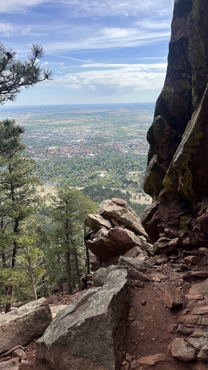
In the first section, you will cross a large rock field into the trees and will switchback upwards. At a point it opens and you have a view back down to Chautauqua and parts of Boulder. Continue on, and upwards.
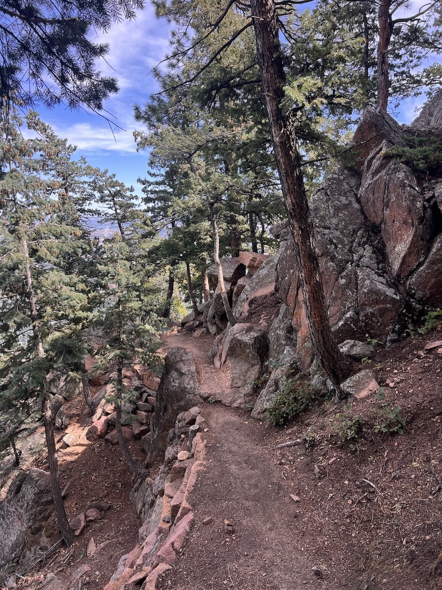
The trail can be hard to see at times because it gets very rocky. Take your time and keep an eye on the route. After some more switchbacks, you arrive at a location where you will have to climb and scramble upwards. Use the footholds in the rock and climb up like small stairs. After this short climb/scramble take in the good vantage point of Boulder and more. Continue on and up. There are several points where you have to take a moment and look for the path or way forward as things get rocky.
Stay on the trail, do not take short cuts. You can see how much work has had to be done to combat erosion from hikers not staying on the switchback trails.
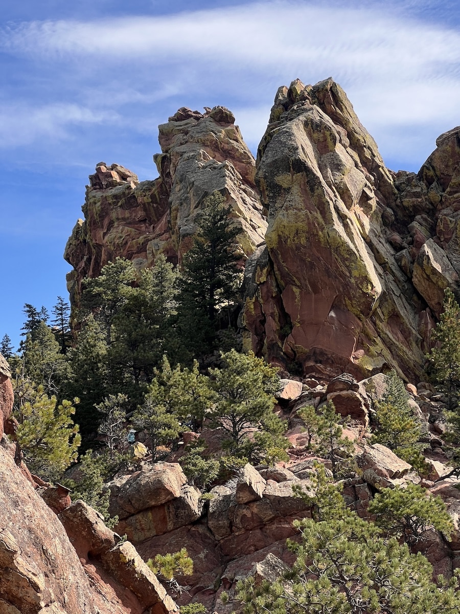
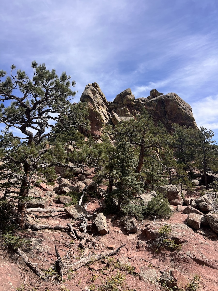
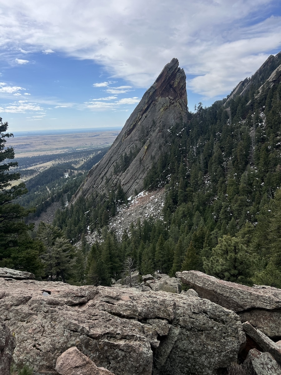
The steep trail switchbacks more in the top half of the 1st/2nd Flatiron Trail. Eventually you pop up out of the trees and there are very clear views of the First Flatiron. At this rocky point that seems to be the top you actually continue on, over, and then up more to the right. More switchbacking to another clearing of less trees just behind the First Flatiron.
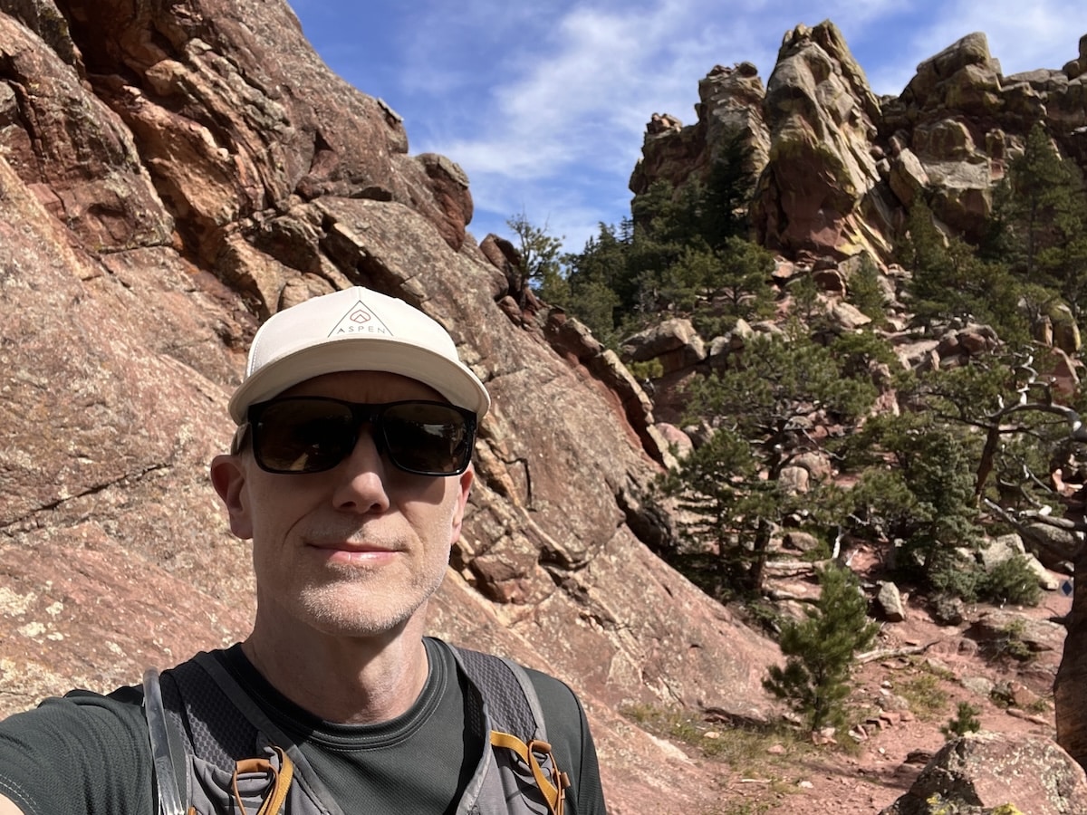
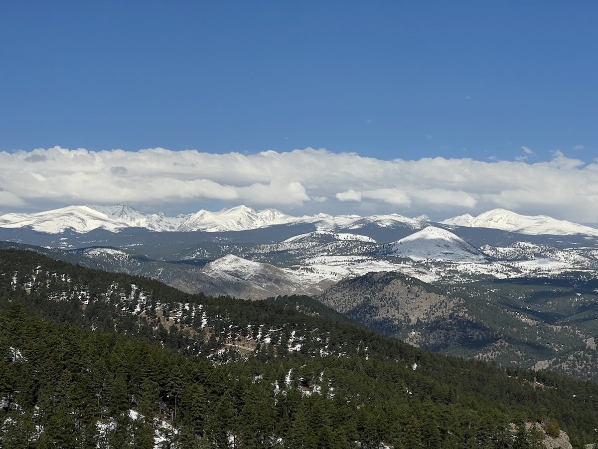
Follow my recording below and you can scramble up on the backside of the First Flatiron. When you have stable footing or a place to sit, turn around and take in the view of the Continental Divide and the tall mountain peaks of Indian Peaks Wilderness Area. To the North you can see North Boulder, and Mount Meeker and Longs Peak in Rocky Mountain National Park. The views are really awesome. That is why I like this hike – quickest way to views of the high alpine to the West. This sight is most impressive after a recent snowstorm.
An out and back is one way to do this hike. If you do it as an out and back, you could extend your hike by adding on Flatirons Loop Trail, or even Royal Arch Trail if you are feeling ambitious and are fit.
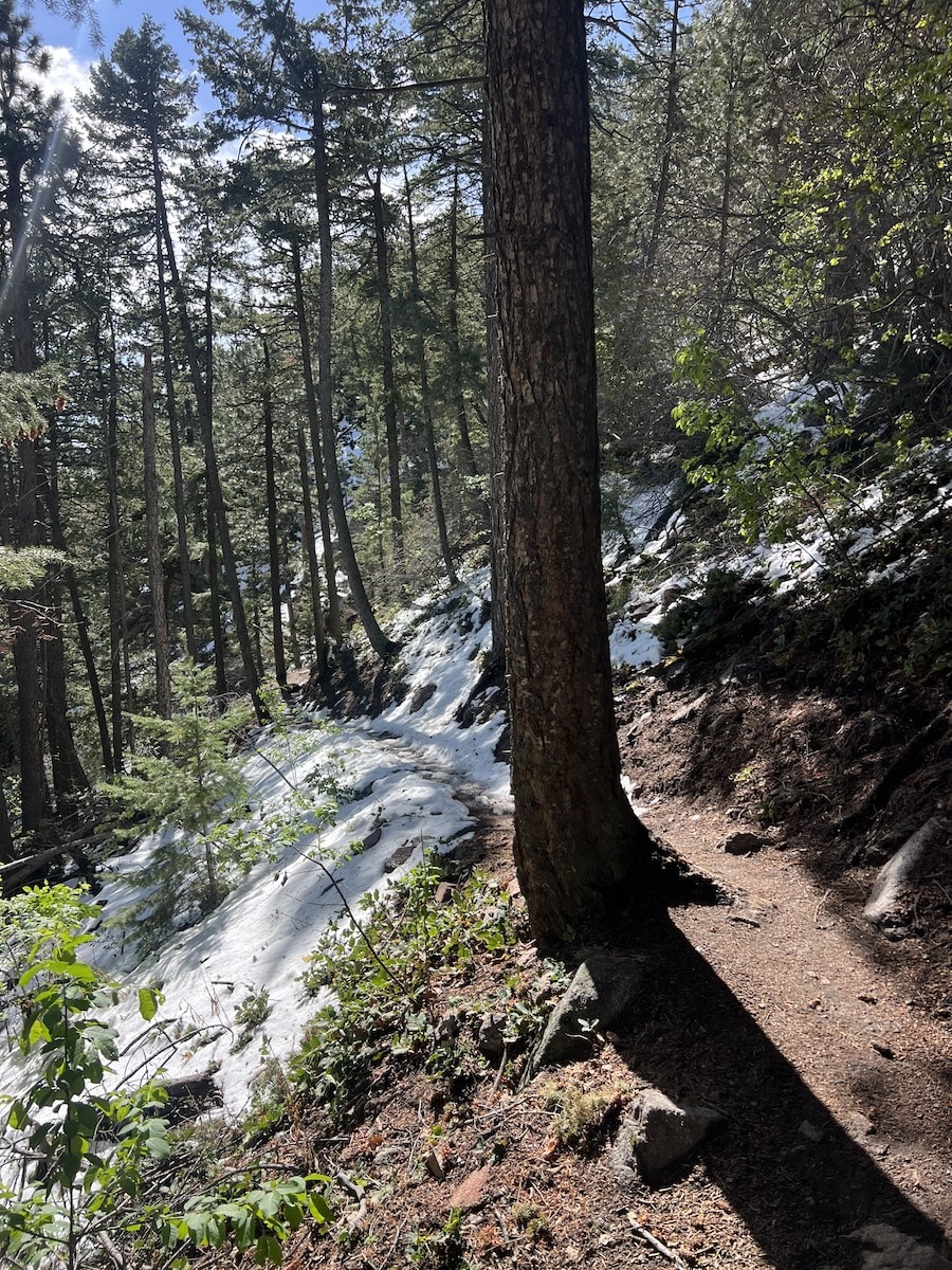
Or, from the top of the 1st/2nd Flatiron Trail, continue on hiking across the new Saddle Rock Connector trail that takes you to where Saddle Rock Trail connects from below, and a bit further to a key location. I think the Saddle Rock Connector is a really cool segment that many people miss when hiking in Boulder. It’s also handy if you want to hike to the West. Follow the trail to where Saddle Rock Trail intersects. At this juncture, you could go down and loop back to Chautauqua. The Saddle Rock trail descends to Gregory Canyon trailhead. From there, take Baseline Trail or Meadow Trail back to Chautauqua where you started out.
For a longer day hike – instead of going down the Saddle Rock Trail, continue on a touch further (on what is really still Saddle Rock Connector) until you arrive at a fork in the trail. You can go down EM Greenman trail (to the right) and loop back down Gregory Canyon Trail. I quite enjoy trail running down this trail. Or, go up (to the left) EM Greenman Trail further up to the summit of Green Mountain. See my recording below that is a big Green Mountain summit loop that started by doing 1st/2nd Flatiron Trail!
You could also start a 1st/2nd Flatiron hike from Gregory Canyon trailhead. For a counter clockwise loop, head up Saddle Rock Trail until you get to Saddle Rock Connector. Turn left, and follow the trail until you get to an opening of really cool rock formations that are located just West of the back of the First Flatiron. Follow small signs and signs on trees to navigate mostly East to a short trail that switchbacks up to the back of the First Flatiron. You will see a sign at this location. If you wish, go closer up to the back of the First Flatiron for those stupendous views West to the Continental Divide. Or, continue down the 1st/2nd Flatiron Trail all the way back to Flatiron Loop Trail and turn left. Then, jog over to Bluebell-Baird Trail that will take you to Gregory Canyon trailhead.
Final thoughts
You can’t go wrong heading up 1st/2nd Flatiron Trail. It’s the fastest route to see views West of Indian Peaks Wilderness Area and North West of Mount Meeker and Longs Peak in Rocky Mountain National Park. The 1st/2nd Flatiron Trail is also a great way to summit Green Mountain and circle back via Ranger Trail and Gregory Canyon.
Photos on my 1st/2nd Flatiron hikes in beautiful Boulder Colorado!